Tuesday, 4 April 2023

list of indian president


India's President List.


Here is a list of all the Presidents of India since the country gained independence in 1947:
  1. Dr. Rajendra Prasad (1950-1962)
  2. Dr. Sarvepalli Radhakrishnan (1962-1967)
  3. Dr. Zakir Hussain (1967-1969)
  4. Varahagiri Venkata Giri (1969-1974)
  5. Fakhruddin Ali Ahmed (1974-1977)
  6. Neelam Sanjiva Reddy (1977-1982)
  7. Giani Zail Singh (1982-1987)
  8. R. Venkataraman (1987-1992)
  9. Shankar Dayal Sharma (1992-1997)
  10. K. R. Narayanan (1997-2002)
  11. Dr. A. P. J. Abdul Kalam (2002-2007)
  12. Pratibha Patil (2007-2012)
  13. Pranab Mukherjee (2012-2017)
  14. Ram Nath Kovind (2017-2022)
  15. Droupadi Murmu (2022-present, as of April 2023)

Note: The President of India is elected for a term of five years by an Electoral College consisting of members of the Lok Sabha, Rajya Sabha (both houses of the Indian Parliament), and the Legislative Assemblies of the States. 

INDIAN PRIME MINISTER LIST


Indian Prime Ministers List -Here is a list of Indian prime ministers and their work periods:

  1. Jawaharlal Nehru: August 15, 1947 - May 27, 1964
  2. Gulzarilal Nanda (acting): May 27, 1964 - June 9, 1964
  3. Lal Bahadur Shastri: June 9, 1964 - January 11, 1966 what is global warming
  4. Gulzarilal Nanda (acting): January 11, 1966 - January 24, 1966
  5. Indira Gandhi: January 24, 1966 - March 24, 1977
  6. Morarji Desai: March 24, 1977 - July 28, 1979
  7. Charan Singh: July 28, 1979 - January 14, 1980
  8. Indira Gandhi: January 14, 1980 - October 31, 1984
  9. Rajiv Gandhi: October 31, 1984 - December 2, 1989
  10. V. P. Singh: December 2, 1989 - November 10, 1990
  11. Chandra Shekhar: November 10, 1990 - June 21, 1991
  12. P. V. Narasimha Rao: June 21, 1991 - May 16, 1996
  13. Atal Bihari Vajpayee: May 16, 1996 - June 1, 1996 Pacific Ocean
  14. H. D. Deve Gowda: June 1, 1996 - April 21, 1997
  15. Inder Kumar Gujral: April 21, 1997 - March 19, 1998
  16. Atal Bihari Vajpayee: March 19, 1998 - May 22, 2004 health&diet
  17. Manmohan Singh: May 22, 2004 - May 26, 2014
  18. Narendra Modi: May 26, 2014 - Present

Monday, 3 April 2023

Capital & country of asia


Asie: pays, capitales, monnaies

here's a list of countries, capitals, and usable currencies in Asia:
        Country       ----- capital--- currency
  1. Afghanistan - Kabul - Afghan Afghani
  2. Armenia - Yerevan - Armenian Dram
  3. Azerbaijan - Baku - Azerbaijani Manat
  4. Bahrain - Manama - Bahraini Dinar
  5. Bangladesh - Dhaka - Bangladeshi Taka
  6. Bhutan - Thimphu - Bhutanese Ngultrum and Indian Rupee
  7. Brunei - Bandar Seri Begawan - Brunei Dollar
  8. Cambodia - Phnom Penh - Cambodian Riel and US Dollar
  9. China - Beijing - Chinese Yuan Renminbi
  10. Cyprus - Nicosia - Euro
  11. Georgia - Tbilisi - Georgian Lari
  12. India - New Delhi - Indian Rupee
  13. Indonesia - Jakarta - Indonesian Rupiah
  14. Iran - Tehran - Iranian Rial
  15. Iraq - Baghdad - Iraqi Dinar
  16. Israel - Jerusalem (but recognized as Tel Aviv) - Israeli Shekel
  17. Japan - Tokyo - Japanese Yen
  18. Jordan - Amman - Jordanian Dinar
  19. Kazakhstan - Nur-Sultan (formerly Astana) - Kazakhstani Tenge
  20. Kuwait - Kuwait City - Kuwaiti Dinar
  21. Kyrgyzstan - Bishkek - Kyrgyzstani Som
  22. Laos - Vientiane - Lao Kip
  23. Lebanon - Beirut - Lebanese Pound
  24. Malaysia - Kuala Lumpur - Malaysian Ringgit
  25. Maldives - Male - Maldivian Rufiyaa
  26. Mongolia - Ulaanbaatar - Mongolian Tugrik
  27. Myanmar (formerly Burma) - Naypyidaw (but recognized as Yangon) - Myanmar Kyat
  28. Nepal - Kathmandu - Nepalese Rupee
  29. North Korea (Democratic People's Republic of Korea) - Pyongyang - North Korean Won
  30. Oman - Muscat - Omani Rial
  31. Pakistan - Islamabad - Pakistani Rupee
  32. Palestine - Ramallah (but recognized as Jerusalem) - Israeli Shekel, Jordanian Dinar, and US Dollar
  33. Philippines - Manila - Philippine Peso
  34. Qatar - Doha - Qatari Riyal
  35. Russia - Moscow - Russian Ruble
  36. Saudi Arabia - Riyadh - Saudi Riyal
  37. Singapore - Singapore - Singapore Dollar
  38. South Korea (Republic of Korea) - Seoul - South Korean Won
  39. Sri Lanka - Colombo - Sri Lankan Rupee
  40. Syria - Damascus - Syrian Pound
  41. Taiwan - Taipei - New Taiwan Dollar
  42. Tajikistan - Dushanbe - Tajikistani Somoni
  43. Thailand - Bangkok - Thai Baht
  44. Timor-Leste (East Timor) - Dili - US Dollar.what is Pacific Ocean
  45. Turkey - Ankara - Turkish Lira
  46. Turkmenistan - Ashgabat - Turkmenistan Manat
  47. United Arab Emirates - Abu Dhabi - UAE Dirham
  48. Uzbekistan - Tashkent - Uzbekistani Som
  49. Vietnam - Hanoi - Vietnamese Dong
  50. Yemen - Sana'a - Yemeni Rial

Please note that some countries may have more than one usable currency due to various factors such as proximity to other countries, economic policies, etc.      Motivational quotes of the day-Believe in yourself and your abilities, and success will follow."

special request๐Ÿ™--Please forward this blog further so that it can reach out to the needy and helpless people who can also read it.

Sunday, 2 April 2023

Knowledge korner 123

For the website "Knowledge Korner 123", some relevant categories in English language could be:

  1. Education and Learning
  2. Science and Technology
  3. History and Culture
  4. Health and Wellness
  5. Arts and Entertainment
  6. Home and Garden

I hope this helps! Let me know if you have any other questions or if there is anything else I can assist you with.

Saturday, 1 April 2023

southern Ocean


Southern Ocean Overview.

Southern Ocean overview  what is google map
The Southern Ocean is the ocean that surrounds Antarctica and is also known as the Antarctic Ocean. It is the smallest and the youngest of the world's oceans, having been defined by the International Hydrographic Organization (IHO) in 2000.

The Southern Ocean is located south of the 60th parallel and is bounded by the coastlines of Antarctica, South America, South Africa, and Australia. It covers approximately 20% of the Earth's surface and has a volume of around 71 million cubic kilometers. The ocean's surface area is about 35 million square kilometers.

The Southern Ocean is characterized by strong and persistent westerly winds and the Antarctic Circumpolar Current, which is the only current that flows completely around the Earth. The ocean is known for its unique and diverse marine life, including penguins, seals, whales, and various types of fish.queenraj blogger

The Southern Ocean plays a critical role in global climate and ocean circulation, as it is a major sink for carbon dioxide and heat. It also serves as an important area for scientific research, particularly in the study of climate change and the ocean's role in regulating global temperatures. However, the Southern Ocean is facing increasing environmental challenges, including climate change, overfishing, and pollution, which threaten its fragile ecosystems.

shape of southern Ocean--

The shape of the Southern Ocean can be described as roughly circular or elliptical, with Antarctica as its center. The Southern Ocean is sometimes also referred to as the Antarctic Ocean, as it surrounds the continent of Antarctica. Its boundaries are somewhat debatable, but it is generally considered to be the body of water that lies south of 60 degrees south latitude, and is bounded by the coastlines of South America, Africa, Australia, and Antarctica. The Southern Ocean is the smallest and youngest of the world's oceans, having only been recognized as a distinct body of water in the early 21st century.

Depth of southern Ocean--The Southern Ocean has an average depth of about 3,270 meters (10,728 feet). The deepest point in the Southern Ocean is the South Sandwich Trench, which has a maximum depth of approximately 7,235 meters (23,737 feet). However, the exact depth can vary in different areas of the Southern Ocean, as the ocean floor is not uniformly flat and can have ridges, seamounts, and other geological features.

Surface of southern Ocean--

The Southern Ocean, also known as the Antarctic Ocean, is the body of water that surrounds Antarctica and is generally considered to be the southernmost parts of the world's oceans.Pacific Ocean

The exact surface area of the Southern Ocean can vary depending on how it is defined, but according to the International Hydrographic Organization (IHO), the Southern Ocean has an area of approximately 20.33 million square kilometers (7.85 million square miles).

This includes all the water below 60 degrees South latitude, which is the official boundary of the ocean according to the IHO. However, some sources may include a wider area, encompassing parts of the South Atlantic, Indian, and Pacific Oceans, resulting in a larger surface area.

Southern Ocean coast---

The Southern Ocean is the body of water that surrounds the continent of Antarctica, and it does not have a specific coast as it is an open ocean. However, there are several countries that have coastal areas along the Southern Ocean, including:
  1. Australia: The southern coast of Australia faces the Southern Ocean, including the Great Australian Bight, which is a large open bay.Atlantic Ocean

  2. New Zealand: The southern coast of New Zealand faces the Southern Ocean, including the Foveaux Strait, which separates the South Island from Stewart Island.

  3. South Africa: The southern coast of South Africa faces the Southern Ocean, including the Cape of Good Hope, which is the southernmost point of the African continent.

  4. Argentina: The southern coast of Argentina faces the Southern Ocean, including Tierra del Fuego, which is an archipelago at the southern tip of South America.

  5. Chile: The southern coast of Chile faces the Southern Ocean, including Cape Horn, which is the southernmost point of the South American continent.

These coastal areas can experience extreme weather conditions, including strong winds and large waves, due to the Southern Ocean's location and exposure to the westerly winds.               

.Rivers fall in southern Ocean

The Southern Ocean, also known as the Antarctic Ocean or the Austral Ocean, surrounds the continent of Antarctica and extends northward to the 60th parallel. It is the world's smallest and youngest ocean, having formed around 30 million years ago. There are several rivers that flow into the Southern Ocean, including:

1.Murray River: The Murray River is Australia's longest river, stretching over 2,500 kilometers (1,553 miles) from its source in the Australian Alps to its mouth at Lake Alexandrina on the southern coast of Australia. The river discharges into the Southern Ocean via a network of channels and lagoons at the Murray Mouth.

2.Derwent River: The Derwent River is a major river in Tasmania, Australia. It flows southwards for over 200 kilometers (124 miles) from its source in Lake St Clair to its mouth at Storm Bay on the southern coast of Tasmania, which opens into the Southern Ocean.

3.Waikato River: The Waikato River is New Zealand's longest river, stretching over 425 kilometers (264 miles) from its source in Lake Taupo to the Tasman Sea. The river flows into the Firth of Thames, which is an arm of the Southern Ocean.

4.Clutha River: The Clutha River is the second longest river in New Zealand, flowing over 340 kilometers (211 miles) from its source in the Southern Alps to the Pacific Ocean. The river's mouth is located at the town of Balclutha on the southern coast of New Zealand, which opens into the Southern Ocean.

5.Onyx River: The Onyx River is a short river on the continent of Antarctica, flowing only 32 kilometers (20 miles) from its source in the Wright Lower Glacier to its mouth at Lake Vanda, which is a closed basin located near the coast of the Ross Sea, a marginal sea of the Southern Ocean.

southern Ocean continents & countries-
The Southern Ocean surrounds Antarctica and does not have any continents or countries bordering it. However, several countries have territorial claims on Antarctica, which is located within the Southern Ocean. These include:
  1. Australia
  2. France
  3. New Zealand
  4. Norway
  5. United Kingdom
  6. Chile
  7. Argentina

However, it is important to note that these territorial claims are not universally recognized and are subject to ongoing disputes. Additionally, the Antarctic Treaty System, which came into effect in 1961, governs the use of Antarctica and designates it as a scientific preserve.. 

Southern Ocean length--The Southern Ocean is the smallest of the world's oceans and is also known as the Antarctic Ocean. Its length is approximately 14,000 kilometers (8,700 miles), stretching from the coast of Antarctica to 60 degrees south latitude. The exact length of the Southern Ocean is somewhat difficult to determine due to its irregular shape and the fact that its northern boundary is not well-defined, but this estimate is generally accepted by most experts in the field.

velocity of southern Ocean--

The velocity of the Southern Ocean can vary greatly depending on the location, depth, and time of year. The Southern Ocean is known for its strong and variable currents, which are driven by a combination of winds, tides, and ocean circulation patterns.

One of the most well-known currents in the Southern Ocean is the Antarctic Circumpolar Current (ACC), which flows from west to east around Antarctica. The ACC is the strongest current in the world ocean and has an average velocity of around 150-200 cm/s (0.5-0.7 mph) at the surface.

However, the velocity of the ACC can vary greatly depending on the location and depth. At depths below 1000 meters (3281 feet), the velocity of the ACC can reach up to 400 cm/s (1.3 mph) in some areas.

In addition to the ACC, there are also other currents in the Southern Ocean, such as the Weddell Sea Gyre and the East Antarctic Current, which have their own unique velocities and patterns of movement.

Overall, the velocity of the Southern Ocean is complex and highly variable, and is still being studied and understood by oceanographers and climate scientists.

southern Ocean temprature--

The temperature of the Southern Ocean varies depending on the location and time of year. Generally, the Southern Ocean is colder than other oceans because it is located in the high latitudes of the southern hemisphere and is influenced by cold polar winds and currents.

According to data from the National Oceanic and Atmospheric Administration (NOAA), the average sea surface temperature in the Southern Ocean ranges from about -2°C (28°F) in winter to about 5°C (41°F) in summer. However, temperatures can vary widely depending on location and can be affected by factors such as ocean currents and winds.

In addition to surface temperatures, the Southern Ocean also has a deep layer of cold, dense water that is formed through a process called Antarctic Bottom Water formation. This water can have temperatures as low as -1.8°C (28.8°F) and plays an important role in the global ocean circulation.

commercial use of southern Ocean---

The Southern Ocean is a vast and largely unexplored region of the world's oceans. It surrounds the continent of Antarctica and is home to a diverse range of marine life, including many species of whales, seals, and penguins. The Southern Ocean is also a crucial area for global climate regulation and ocean circulation.

Commercial use of the Southern Ocean is regulated by international agreements, including the Convention on the Conservation of Antarctic Marine Living Resources (CCAMLR) and the United Nations Convention on the Law of the Sea (UNCLOS). These agreements aim to ensure the sustainable use of the ocean's resources while protecting its unique ecosystem and biodiversity.

Commercial activities in the Southern Ocean include fishing, shipping, and tourism. Fishing is the most significant commercial activity in the region, with fishing vessels targeting krill, toothfish, and other species. However, fishing is strictly regulated by CCAMLR, which sets catch limits and monitors fishing activity to ensure that it is sustainable.

Shipping is also an important commercial activity in the Southern Ocean, with vessels transporting goods and supplies to research stations and other facilities in the region. However, shipping is subject to strict regulations to prevent pollution and protect the environment.

Tourism is a growing industry in the Southern Ocean, with tourists visiting the region to see its unique wildlife and landscapes. However, tourism is also subject to strict regulations to minimize its impact on the environment and wildlife.

In conclusion, commercial use of the Southern Ocean is carefully regulated to ensure that it is sustainable and does not harm the unique ecosystem and biodiversity of the region. The international agreements governing commercial activities in the Southern Ocean are essential to protecting this fragile and important part of the world's oceans.

Colour of southern Ocean--The Southern Ocean is usually described as having a deep blue color. However, the color of the ocean can vary depending on factors such as the angle of the sun, cloud cover, and the presence of phytoplankton or other marine organisms. In some areas, the Southern Ocean may also have a greenish hue due to the presence of microscopic algae called phytoplankton. Overall, the color of the Southern Ocean can be quite striking and beautiful, especially in areas where icebergs are present and the water appears a bright, icy blue.

Difficult Ocean conditions--

Why is the ocean condition difficult in the southern sea (south of cape horn)?

The ocean conditions in the Southern Sea, also known as the Southern Ocean, are notoriously difficult due to a combination of several factors.

Firstly, the Southern Sea is located at a very high latitude, which means it is subject to extreme weather conditions such as strong winds, storms, and waves. In particular, the Antarctic Circumpolar Current, which flows around the continent of Antarctica, contributes to some of the strongest and most treacherous ocean currents in the world.

Secondly, the Southern Sea is largely unobstructed by land masses, which means that the waves are able to build up to enormous sizes over long distances, resulting in very rough seas. The area is also known for its large icebergs, which can pose a significant hazard to ships.

Thirdly, the water temperature in the Southern Sea is very cold, often close to freezing point. This means that the ocean is very dense, which can create difficult conditions for ships to navigate through.

All of these factors combine to make the Southern Sea a challenging environment for sailors and ship operators. In particular, the combination of high winds, extreme waves, and low temperatures can create dangerous conditions for ships, which require careful navigation and preparation to ensure safe passage.

Southern Ocean recognition-- Southern Ocean was officially recognized as the Earth's fifth ocean by the International Hydrographic Organization in 2000, although the concept of a distinct southern ocean has been recognized by scientists and explorers for centuries.

Disclaimer--The above blog is related to the Southern Ocean and contains various multimedia content. I have curated and presented it before you.

Friday, 31 March 2023

indian Ocean


Indian Ocean Overview.


The Indian Ocean is the third-largest ocean in the world, covering approximately 20% of the Earth's surface. It is bounded by the coasts of Africa to the west, Asia to the north, Australia to the east, and the Southern Ocean to the south.

The Indian Ocean is characterized by warm temperatures, strong currents, and a diverse array of marine life. The ocean is home to many important fisheries and supports the livelihoods of millions of people living in the surrounding regions.

The Indian Ocean has played a significant role in global trade and commerce for centuries, with major ports and trade routes connecting Africa, Asia, and Europe. Today, the ocean continues to be an important hub for shipping and transportation, with major ports located in countries such as India, Sri Lanka, and South Africa.

The Indian Ocean is also home to many important natural resources, including oil and gas reserves, minerals, and valuable fish stocks. However, these resources are often a source of conflict and tension between the countries that share the ocean, and issues such as overfishing and pollution are major concerns for the health of the ocean and its ecosystems.

Shape of Indian Ocean--The Indian Ocean is roughly triangular in shape, bordered by the Indian subcontinent to the north, the Arabian Peninsula and Africa to the west, and the Indonesian archipelago to the east. The ocean covers an area of about 70.56 million square kilometers, making it the third-largest ocean in the world after the Pacific and Atlantic Oceans. The northern part of the Indian Ocean is relatively shallow, while the southern part is much deeper, with an average depth of over 3,900 meters.

Depth of Indian Ocean-The Indian Ocean has an average depth of about 3,890 meters (12,762 feet). The maximum depth of the Indian Ocean is found in the Java Trench, which reaches a depth of about 7,725 meters (25,344 feet) below sea level. The deepest part of the Indian Ocean is located in the southern end of the Java Trench, known as the Diamantina Deep, which has a depth of about 8,047 meters (26,401 feet).

Length of indian Ocean--The Indian Ocean has a length of approximately 10,000 kilometers (6,200 miles) from its northernmost point to its southernmost point, and a width of approximately 7,500 kilometers (4,600 miles) from its westernmost point to its easternmost point. However, it's important to note that the coastline of the Indian Ocean is highly irregular, with many bays, peninsulas, and islands, which makes it difficult to determine an exact length.

velocities in indian Ocean-

The Indian Ocean is the third-largest ocean in the world, covering an area of approximately 70.56 million square kilometers. Its average depth is around 3,890 meters, and it has a maximum depth of 7,258 meters in the Java Trench.

The surface currents of the Indian Ocean are influenced by the monsoon winds, which blow in opposite directions in winter and summer. During the winter monsoon (November to March), the northeasterly trade winds blow across the northern Indian Ocean, creating a clockwise circulation pattern. During the summer monsoon (June to September), the southwesterly winds create a counterclockwise circulation pattern.

The velocity of the surface currents in the Indian Ocean varies depending on the location, season, and other factors. The Agulhas Current, which flows along the east coast of South Africa, has a velocity of around 2-3 knots (3.7-5.6 km/h), making it one of the fastest ocean currents in the world. In contrast, the equatorial currents in the central and eastern parts of the Indian Ocean have velocities of around 0.2-0.5 knots (0.4-0.9 km/h).

Overall, the Indian Ocean's surface currents and velocities are complex and influenced by a variety of factors, including the monsoon winds, ocean temperature, and geography.

Colour of Indian Ocean--The color of the Indian Ocean can vary depending on many factors such as the time of day, weather conditions, and the location within the ocean. Typically, the color of the Indian Ocean appears to be a deep blue to greenish-blue hue. However, it can also appear to be darker or lighter depending on the specific location and conditions at that time.

Temprature of indian Ocean--you can easily check the current temperature of the Indian Ocean by searching online for a reliable weather or oceanography website. Additionally, it's worth noting that the temperature of the Indian Ocean can vary depending on the location, time of year, and other factors.

.coast of indian Ocean--

The Indian Ocean is the third-largest ocean in the world, covering an area of approximately 70.56 million square kilometers. It is bounded by Africa to the west, Asia to the north, Australia to the east, and the Southern Ocean to the south.

The Indian Ocean has a vast coastline that spans across several countries. Some of the countries with a coastline along the Indian Ocean include:South Africa,,Mozambique,Tanzania,Kenya,Somalia,Yemen,Oman,Iran,Pakistan,India,Sri Lanka,Bangladesh,Myanmar,Thailand,Malaysia,Indonesia,Australia

The coastline of the Indian Ocean is incredibly diverse, with sandy beaches, rocky cliffs, coral reefs, and mangrove forests. It is home to a wide variety of marine life, including dolphins, whales, sharks, turtles, and many species of fish.

Rivers fall of indian Ocean--

There are many rivers that fall into the Indian Ocean, but here are some of the major ones:

1.Ganges River: The Ganges is the largest river in India and one of the most sacred rivers in Hinduism. It flows from the Himalayas in northern India and empties into the Bay of Bengal, which is a part of the Indian Ocean.

2.Brahmaputra River: The Brahmaputra is a trans-boundary river that flows through China, India, and Bangladesh. It originates in Tibet and flows through northeastern India before emptying into the Bay of Bengal.

3.Godavari River: The Godavari is the second-longest river in India after the Ganges. It flows through the states of Maharashtra, Telangana, Andhra Pradesh, Chhattisgarh, and Odisha before emptying into the Bay of Bengal.

4.Krishna River: The Krishna is one of the major rivers in southern India. It flows through the states of Maharashtra, Karnataka, and Andhra Pradesh before emptying into the Bay of Bengal.

5.Cauvery River: The Cauvery is a major river in southern India that originates in the Western Ghats and flows through the states of Karnataka and Tamil Nadu before emptying into the Bay of Bengal.

6.Zambezi River: The Zambezi is the fourth-longest river in Africa and the largest river that falls into the Indian Ocean. It flows through six countries in southern Africa, including Zambia, Angola, Namibia, Botswana, Zimbabwe, and Mozambique, before emptying into the Indian Ocean.

These are just a few examples, as there are many more rivers that empty into the Indian Ocean from various countries.

indian Ocean continents & countries--

The Indian Ocean is the third largest ocean in the world, covering approximately 20% of the Earth's surface. It is bounded by the African continent to the west, the Asian continent to the north, Australia to the east, and the Southern Ocean to the south.

Here are some facts about the continents and countries that border the Indian Ocean:

1.Africa: The African continent borders the western edge of the Indian Ocean. Countries such as South Africa, Mozambique, Tanzania, Kenya, Somalia, and Madagascar are located along the eastern coast of Africa and are directly adjacent to the Indian Ocean.

2.Asia: The Asian continent borders the northern edge of the Indian Ocean. Countries such as India, Pakistan, Bangladesh, Sri Lanka, Thailand, Indonesia, Malaysia, and Myanmar have coastlines along the Indian Ocean.

3.Australia: The Australian continent is located to the east of the Indian Ocean. The country of Australia has a coastline that borders the southern edge of the Indian Ocean.

4.Islands: There are many islands located within the Indian Ocean, including the Maldives, Seychelles, Mauritius, Comoros, and the Andaman and Nicobar Islands. These islands are scattered throughout the ocean and are home to many unique species of plants and animals.

Overall, the Indian Ocean is a diverse and important body of water, with many countries and cultures depending on it for trade, transportation, and natural resources

Note--The term "Indian Ocean" was first used by the Greek geographer Ptolemy in the 2nd century AD, and it has been used ever since. The name "Indian" refers to the subcontinent of India, which borders the ocean to the north.

Unique facts of indian Ocean--India is the country that touches the Indian Ocean, the Arabian Sea, and the Bay of Bengal.

Five similarities&differences between Atlantic & indian Ocean---

Both the Atlantic and Indian Ocean are saltwater bodies and are connected by the Southern Ocean.

Both oceans have similar average depths of around 3,800 meters.

Both oceans have a similar pattern of ocean currents and are influenced by the global circulation system.

Both oceans have a significant impact on the climate and weather patterns of the regions surrounding them.

Both oceans are home to a diverse range of marine life, including large fish, marine mammals, and various species of plankton.

Five differences between the Atlantic and Indian Ocean are:

The Atlantic Ocean is approximately three times larger than the Indian Ocean.

The Atlantic Ocean has a wider and more pronounced continental shelf, while the Indian Ocean has a narrower and less prominent shelf.

The Indian Ocean is generally warmer than the Atlantic Ocean, especially in the tropical regions.

The Atlantic Ocean has a higher salinity level than the Indian Ocean, primarily due to its higher evaporation rates.

The Atlantic Ocean is more affected by hurricanes and tropical storms, while the Indian Ocean is more prone to cyclones and typhoons.

Andaman island location between bay of bengal & indian Ocean--The Andaman and Nicobar Islands is the island group that lies between the Bay of Bengal and the Indian Ocean. They are a Union Territory of India and consist of 572 islands, out of which only a few are inhabited. The Andaman and Nicobar Islands are located in the southeastern part of the Bay of Bengal and are separated from the mainland of India by the Andaman Sea. The nearest point of the Indian mainland to the Andaman Islands is about 150 km away.

indian Ocean commercial activities--

The Indian Ocean is an important area for commercial activities, including shipping, fishing, oil and gas exploration, and tourism.

,1.Shipping is one of the primary commercial activities in the Indian Ocean, with large amounts of goods being transported between Asia, Europe, and Africa. Major ports in the Indian Ocean include Singapore, Mumbai, Colombo, and Durban.

2.Fishing is also an important activity in the Indian Ocean, with many countries relying on the ocean's resources for food and income. Some of the most important fish stocks in the Indian Ocean include tuna, mackerel, and sardines.

3.The Indian Ocean is also a significant source of oil and gas, with major reserves found off the coasts of countries such as India, Iran, and Saudi Arabia. Exploration and production activities are carried out by both national and international companies.

4.Tourism is another important commercial activity in the Indian Ocean, with countries such as the Maldives, Mauritius, and Seychelles attracting large numbers of visitors each year.

Overall, the Indian Ocean plays a crucial role in the global economy, and its commercial use is likely to continue to grow in the years to come.

Sea Distance between india&srilanka--The sea distance between India and Sri Lanka varies depending on the specific locations on each country's coastline that are being measured. However, the shortest distance between India and Sri Lanka is approximately 31 kilometers (19.3 miles), which is the distance between the southern tip of India (at Kanyakumari) and the northernmost point of Sri Lanka (at Talaimannar). This stretch of water is known as the Palk Strait.

Indian Ocean garbage patch--The Indian Ocean garbage patch is located in the Indian Ocean, between Africa and Australia. However, it's important to note that the Indian Ocean garbage patch is not a fixed or centralized location like some other well-known garbage patches, such as the Great Pacific Garbage Patch. Rather, it is a region in the Indian Ocean where marine debris accumulates due to ocean currents and wind patterns. The exact location and size of the Indian Ocean garbage patch can vary depending on seasonal changes and other factors.

indian Ocean dipole--

The Indian Ocean is known to have several dipole modes, which refer to the sea surface temperature (SST) anomalies in the eastern and western parts of the ocean that vary in opposite directions. The two most prominent dipole modes in the Indian Ocean are the Indian Ocean Dipole (IOD) and the Dipole Mode Index (DMI).

The Indian Ocean Dipole (IOD) is characterized by the SST anomalies in the eastern and western parts of the Indian Ocean. During a positive IOD event, the western part of the ocean near the Arabian Sea becomes cooler, while the eastern part near Indonesia and Australia becomes warmer. Conversely, during a negative IOD event, the western part of the ocean becomes warmer and the eastern part becomes cooler.

The Dipole Mode Index (DMI) is another measure of the SST anomalies in the Indian Ocean, which is based on the difference in SST between the western and eastern parts of the ocean. A positive DMI indicates that the western part of the ocean is warmer than the eastern part, while a negative DMI indicates the opposite.

Both the IOD and the DMI are important climate drivers, affecting weather patterns and ocean currents in the Indian Ocean region. These dipole modes can have significant impacts on rainfall, temperature, and sea level in nearby regions, including India, Indonesia, and Australia.

Disclaimer--Various articles related to the Indian Ocean have been curated from different sources such as multimedia and YouTube videos, and presented to you. I cannot confirm their authenticity. Please read them and send them ahead to save your time.


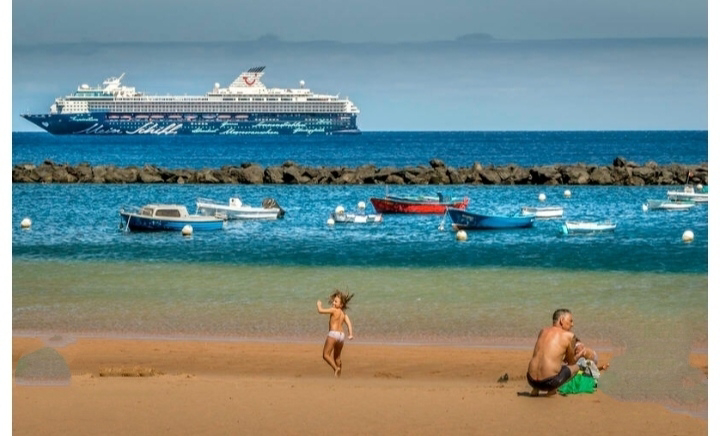


Atlantic Ocean


Atlantic Ocean overview--                   The Atlantic Ocean is the second-largest ocean in the world, covering an area of approximately 106.5 million square kilometers. It is bordered by North and South America to the west, Europe and Africa to the east, and the Southern Ocean to the south. The ocean is named after the mythological figure Atlas, who supported the heavens on his shoulders.

The Atlantic Ocean is divided into two major parts: the North Atlantic and the South Atlantic. The North Atlantic is home to several major currents, including the Gulf Stream, which transports warm water from the Gulf of Mexico to the North Atlantic, and the Labrador Current, which carries cold water from the Arctic. The South Atlantic is generally characterized by a westward flow of ocean currents, with the Brazil Current carrying warm water from the tropics towards the southern tip of South America, and the Benguela Current carrying cool water northwards along the west coast of Africa.

The Atlantic Ocean is home to a diverse array of marine life, including whales, dolphins, seals, sharks, and numerous species of fish. It also has a rich history, with many significant events occurring in or near its waters, such as the sinking of the Titanic, the Battle of the Atlantic during World War II, and the voyages of Christopher Columbus and other explorers. Today, the Atlantic Ocean plays a vital role in global commerce and transportation, with countless ships and planes traversing its waters every day.

Limiting factor of Ocean mixing--
Why does the water from the Atlantic and Pacific Oceans not mix?
The water from the Atlantic and Pacific Oceans do mix to some extent, but there are factors that can limit the extent of their mixing, such as differences in temperature, salinity, and density.
One of the main reasons that the water from the Atlantic and Pacific Oceans do not fully mix is because of the Circumpolar Current, also known as the Antarctic Circumpolar Current. This is a strong, continuous current that flows from west to east around Antarctica, effectively isolating the two oceans from each other. The current is driven by the strong westerly winds that blow over the Southern Ocean, and it is one of the largest ocean currents in the world.
In addition to the Circumpolar Current, there are also other ocean currents and water masses that can help to isolate the Atlantic and Pacific Oceans. For example, the North Atlantic and North Pacific have their own circulation patterns, which can limit the exchange of water between these regions.read must global Warming

Another factor that can limit mixing between the two oceans is the differences in their properties. The Atlantic Ocean is generally saltier and warmer than the Pacific Ocean, which can create a barrier that limits mixing between the two. In addition, the Atlantic Ocean is generally less turbulent than the Pacific Ocean, which can also limit mixing.

Overall, while there is some mixing between the Atlantic and Pacific Oceans, there are a variety of factors that can limit the extent of this mixing.
Coast of Atlantic--Atlantic Ocean touches the coasts of four oceans: the Arctic Ocean to the north, the Southern Ocean to the south, and the Indian Ocean and the Pacific Ocean on the east and west sides respectively. However, it's important to note that the boundaries between the oceans are not always clearly defined, and there are different ways of defining the oceanic regions.
.Rivers that fall Atlantic Ocean--
What are the rivers that fall into Atlantic ocean?

There are many rivers that fall into the Atlantic Ocean, including some of the world's largest and most important rivers. Here are some of the major rivers that flow into the Atlantic Ocean:

1.Amazon River - the largest river in the world by volume of water, located in South America
2.Congo River - the second-largest river in the world by volume of water, located in Africa
3.Orinoco River - a major river in South America, flowing through Venezuela and Colombia
4.Parana River - a river in South America that flows through Brazil, Paraguay, and Argentina
5.St. Lawrence River - a large river in North America that flows through Canada and the United States
6.Mississippi River - a major river in North America that flows through the United States
7.Rio de la Plata - a large estuary in South America that forms the border between Argentina and Uruguay
8.Niger River - a major river in West Africa that flows through several countries including Guinea, Mali, and Nigeria
9.Gambia River - a river in West Africa that flows through Senegal and The Gambia
10.Hudson River - a river in North America that flows through the eastern United States and empties into the Atlantic Ocean near New York City.
These are just some examples of the many rivers that fall into the Atlantic Ocean..Border between caribbean & Atlantic--

The border between the Caribbean Sea and the Atlantic Ocean is generally defined as the line that runs from the eastern edge of the Yucatan Peninsula in Mexico, along the northern coast of Cuba, and then south along the western coast of Hispaniola (shared by Haiti and the Dominican Republic), and then along the eastern coast of Puerto Rico and the Virgin Islands. This line is known as the "Anegada Passage" and it separates the Caribbean Sea from the Atlantic Ocean. However, it's worth noting that there is no universally accepted definition of this border, and some experts may define it slightly differently.
Atlantic Ocean commercial use--

The Atlantic Ocean is a vital waterway for commercial shipping, connecting the major economies of Europe, North America, and South America. The ocean is used extensively for transporting goods such as oil, gas, raw materials, and finished products.

Some of the key commercial uses of the Atlantic Ocean include:

1.Shipping: The Atlantic Ocean is one of the busiest waterways in the world, with thousands of ships crossing it every day. Shipping routes connect major ports in Europe, North America, and South America, carrying goods such as oil, gas, minerals, and agricultural products.

2.Fishing: The Atlantic Ocean is home to a variety of fish species, making it a prime location for commercial fishing. Fishing fleets from countries such as Canada, Norway, and the United States operate in the Atlantic, harvesting species such as cod, herring, and tuna.

3.Oil and gas exploration: The Atlantic Ocean contains significant deposits of oil and gas, and companies such as BP, ExxonMobil, and Shell operate offshore drilling platforms in the region.

4.Tourism: The Atlantic Ocean is a popular destination for tourists, with beaches, resorts, and cruise ships operating in the region.

5.Renewable energy: The Atlantic Ocean is also becoming a significant source of renewable energy, with offshore wind farms being developed off the coasts of countries such as the United Kingdom, Germany, and the United States.

Overall, the commercial use of the Atlantic Ocean is a vital component of the global economy, supporting industries and providing goods and services to millions of people around the world.
.Atlantic Ocean colour s--

The color of the Atlantic Ocean can vary depending on a number of factors, such as the depth of the water, the amount of sunlight reflecting off the surface, and the presence of plankton or other marine organisms.

In general, the Atlantic Ocean appears to be a deep blue or dark blue color, especially in deeper waters where the sunlight is less able to penetrate. Closer to shore, the water may appear greener or even brownish in color, particularly in areas where rivers and other sources of freshwater flow into the ocean.

The presence of algae and other microscopic organisms can also affect the color of the water, with some regions of the Atlantic Ocean appearing to be more green or even red in color during certain times of the year. Additionally, weather and atmospheric conditions can also impact the color of the ocean, with stormy conditions often causing the water to appear more turbulent and less clear.
.Atlantic Ocean facts continents&countries-
(how many continents are there around the Atlantic Ocean? How many countries border its shores (including islands)?)) 

There are two continents that surround the Atlantic Ocean:1.North America and South America to the west, and 2. Europe and Africa to the east.

There are a total of 62 countries that have coastlines along the Atlantic Ocean, including islands. The countries are:

1.North America: Canada, United States, Mexico, Belize, Guatemala, Honduras, Nicaragua, Costa Rica, Panama, Bahamas, Cuba, Jamaica, Haiti, Dominican Republic, Puerto Rico, Trinidad and Tobago

2.South America: Colombia, Venezuela, Guyana, Suriname, French Guiana, Brazil, Uruguay, Argentina, Chile

3.Europe: Iceland, Norway, United Kingdom, Ireland, Portugal, Spain, France, Belgium, Netherlands, Germany, Denmark, Sweden, Norway

4.Africa: Morocco, Western Sahara, Mauritania, Senegal, Gambia, Guinea-Bissau, Guinea, Sierra Leone, Liberia, Ivory Coast, Ghana, Togo, Benin, Nigeria, Cameroon, Equatorial Guinea, Sao Tome and Principe, Gabon, Congo, Democratic Republic of Congo, Angola, Namibia, South Africa. 

Atlantic Hurricanes Exist --

Yes, Atlantic Ocean hurricanes do exist. The Atlantic hurricane season runs from June 1st to November 30th each year, and during this time, hurricanes can form in the Atlantic Ocean. These hurricanes can cause significant damage and pose a threat to people and property in coastal areas. The severity of these storms can vary, and they are classified into categories based on their wind speed, with Category 5 being the most severe. It is important for people living in hurricane-prone areas to have a plan in place to protect themselves and their property in the event of a hurricane.
shape of Atlantic 

The Atlantic Ocean is a large body of saltwater located between the Americas to the west and Europe and Africa to the east. It has an S-shaped form and is approximately 3,850 kilometers (2,400 miles) wide at its widest point and about 12,800 kilometers (7,930 miles) long from its northernmost point to its southernmost point. The Atlantic Ocean is divided into two major parts, the North Atlantic and the South Atlantic, by the equator. The North Atlantic is further divided into the Gulf of Mexico, the Caribbean Sea, and the Mediterranean Sea. The South Atlantic is bounded by the southern coast of South America, the southern coast of Africa, and the Southern Ocean.
Depth of Atlantic--

The depth of the Atlantic Ocean varies depending on the location. The average depth of the Atlantic is around 12,080 feet (3,682 meters), making it the second-deepest ocean in the world after the Pacific. However, the Atlantic Ocean has some areas that are much deeper than this average depth.

The deepest part of the Atlantic Ocean is the Puerto Rico Trench, which reaches a depth of 28,232 feet (8,605 meters) below sea level. This area is located to the east of Puerto Rico and is part of the boundary between the Caribbean and North American tectonic plates.

Other deep areas in the Atlantic include the South Sandwich Trench (23,737 feet or 7,235 meters), the Romanche Trench (24,812 feet or 7,560 meters), and the Angola Basin (20,384 feet or 6,213 meters).
 .Atlantic iceland count--
There are actually many islands in the Atlantic Ocean, including the Azores, Madeira, Cape Verde, the Canary Islands, the Falkland Islands, and the British Isles, among others. However, the number and size of islands in the Atlantic may be perceived as relatively small compared to other oceans like the Pacific or Indian Oceans.
One reason for this is the way the Atlantic Ocean was formed. Unlike the Pacific, which is ringed by a "ring of fire" of active volcanoes and experiences a lot of tectonic activity, the Atlantic is relatively quiet in terms of tectonic activity. It was formed through the splitting apart of the supercontinent Pangaea, which created a long, narrow ocean basin with fewer opportunities for islands to form.

Another reason is that the climate and ocean conditions in the Atlantic are not always conducive to the development of islands. Many islands in the Atlantic are either volcanic in origin or formed from uplifted seafloor. The harsh climate and limited freshwater resources can also make it difficult for plants and animals to colonize these islands and establish thriving ecosystems.

Overall, while there may be fewer islands in the Atlantic compared to other oceans, there are still many diverse and unique islands to explore and enjoy.
Atlantic ocean & Pacific Ocean meet point-

The Atlantic and Pacific Oceans meet at a point called Cape Horn, which is located at the southernmost tip of South America. The area is known for its turbulent waters, strong winds, and unpredictable weather conditions, making it a challenging place for sailors to navigate. Cape Horn has long been an important landmark for ships traveling between the two oceans, and its discovery played a crucial role in the development of global trade and commerce. Today, the area is also a popular destination for tourists and adventurers who come to explore its rugged landscapes and unique wildlife.
Zeppelins crossed Atlantic Ocean--. The first successful transatlantic Zeppelin flight was made by the German airship LZ 127 Graf Zeppelin in 1928, and it was followed by several other transatlantic crossings by various Zeppelins, including the LZ 129 Hindenburg, which famously crashed in 1937. The Zeppelins were a significant technological achievement of their time and represented a milestone in aviation history.Only a handful of Zeppelins actually crossed the Atlantic.

Most famous of which was LZ127 Graf Zeppelin which made 143 crossings.
Largest icelandcin the Atlantic Ocean-The largest island in the Atlantic is Greenland, which is located in the northern part of the Atlantic Ocean. With an area of approximately 836,330 square miles (2,166,086 square kilometers), it is also the world's largest island overall. Greenland is an autonomous territory within the Kingdom of Denmark and is known for its stunning landscapes, including glaciers, fjords, and vast ice sheets.
Atlantic Ocean length--The Atlantic Ocean is approximately 41.1 million square miles (106.4 million square kilometers) in size, but it does not have a specific length. The ocean extends from the Arctic Ocean in the north to the Southern Ocean in the south and is bounded by the continents of North America and South America to the west, and Europe and Africa to the east. The distance between these continents varies, so the length of the Atlantic Ocean cannot be measured in a single number.
Atlantic Ocean temperature--
The temperature of the Atlantic Ocean varies depending on the location, season, and depth. The surface temperature of the Atlantic Ocean can range from around 0-5°C (32-41°F) in the polar regions to around 30°C (86°F) in the tropics during the summer months. In the North Atlantic, the temperature can be affected by the North Atlantic Oscillation, which can cause fluctuations in temperature on a yearly basis.
At greater depths, the temperature of the Atlantic Ocean can be much colder, with temperatures near freezing in the deep ocean. The temperature also varies depending on the ocean currents and their direction. The Gulf Stream, for example, brings warm water from the tropics up along the east coast of North America and into the North Atlantic, which can affect the temperature of the ocean in those regions.
Overall, the Atlantic Ocean is a large and complex body of water, and its temperature can vary significantly depending on the location and other factors.
Disclaimer--I have compiled various multimedia articles related to the Atlantic Ocean from different regions and present them to you. For further information, please contact an experienced expert. I cannot confirm their accuracy.thanx for watching. 


Arctic Ocean

Arctic Ocean Overview. The Arctic Ocean is the smallest and shallowest of the world's five oceans, located in the northernmo...